Friday, October 19, 2012

New Beginnings

Our journey, which has at times felt like a wonderful endless vacation, will finally end in about 2 weeks.  However, not only was the trip a great adventure, but it changed the rest of our lives.  Through a very highly improbable series of circumstances God led us to the Show Me State to show me (Bob) His plans for our lives.  Before I list a few of these circumstances I’ll give a brief preface on our future plans.  We accepted we needed to move because of all the maintenance work and expense of our current home and our reduced retirement income.  And we wanted to do some type of volunteer work but didn’t know what.  The short version is that God showed us our new home at Maranatha Village in Springfield, Missouri.  There is a beautiful pond on the 100 acre property and this is an excellent retirement home location for a long list of reasons.  And He revealed excellent volunteer work through the Assembly of God U.S. MAPS RV Volunteer Ministry.  Both of these options we didn’t know about before our trip.  Now for a list of some of these unlikely circumstances:  Because the Alaska Highway was closed by landslides a couple next to us at the Mile 0 Campground in Dawson Creek BC had camped there longer; this couple gave us their phone number and asked us to call them when we reached Soldotna and they would show us a place to camp.  When they showed us a camping area near Soldotna we “happened” to chose a spot to park next to Dan and Alanna Clark, who are U.S. MAPS RV Volunteers.  This was their first trip to Alaska and they had learned about this place to camp on their travels.  This couple is very friendly, helped Bob catch salmon, and remained in touch with us throughout our trip by texting, since voice service in Alaska and Canada wasn’t included with both our cell phone plans.  They told us about the annual MAPS RV Convention which just “happened” to be on our way home at the time we were expecting to be in the area of Carlinville, Illinois.  Also, the only time our Verizon phone worked (to call out) in Alaska was when we called the U.S. MAPS office in Springfield, Missouri to make reservations for the convention.  At the convention we heard about Maranatha Village in Springfield, Missouri and decided to visit there.  Dan and Alanna invited us to camp with them in Branson, Missouri at a private membership campground near their home, which is 2 ½ hours from Maranatha Village.  There they introduced us to some of their friends and family. 
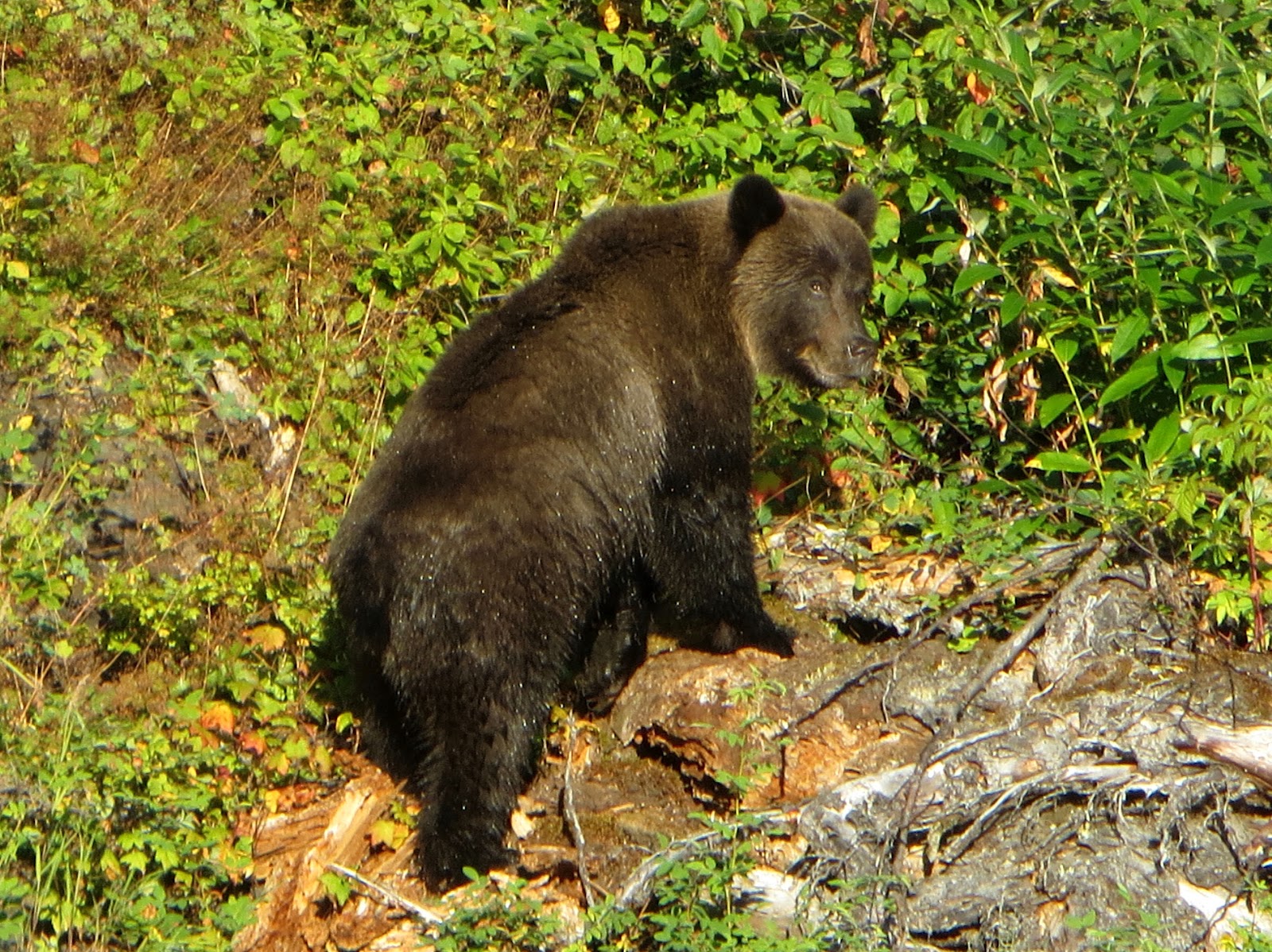
Since the last blog we’ve visited: Devils Tower in Wyoming, the Black Hills of South Dakota including Mount Rushmore, Custer State Park, Wind Cave, and Jewel Cave; the Badlands National Park; Lincoln’s Home National Historic Site.  Also Maranatha Village, the Assemblies of God National Headquarters and other places in and near Springfield, Missouri.  Also, we visited Branson, Table Rock Lake, Big Spring in Ozark Scenic Rivers National Park, and Land Between the Lakes in Kentucky.  Following are a few pictures from our travels:   

Mount Rushmore night illumination.

Badlands National Park

Sunset at Badlands National Park.

A. Lincoln's home in Springfield, Illinois.


Sunday, September 16, 2012

Back in the lower 48 states after a great trip through British Columbia and Alberta, Canada.

From Houston, BC we continued our drive southeast on the Trans Canada Highway through Prince George to Mount Robson Provincial Park.  We saw the top of Mount Robson for a moment when the clouds parted.  On Labor Day weekend we soaked in Miette Hot Springs in Jasper National Park.  Our final week in Canada was like icing on a cake.  Most of the time the weather was excellent.  We had beautiful views of mountains in Jasper, Yoho, Glacier and Mount Revelstoke National Parks.  The Jasper Tramway took us 3297 feet up Whistlers Mountain where we took a steep hike to the top.  At Maligne Lake we took a boat ride to Spirit Island.  Near Kicking Horse Pass in Yoho National Park we watched a train travel through a spiral tunnel.  We drove to near the top of Mount Revelstoke and enjoyed the views from the summit.  We had 2 beautiful free ferry rides across Upper Arrow (Columbia River) and Kootenay Lakes with our RV.  We soaked in 2 beautiful hot springs, Nakusp Hot Springs and Ainsworth Hot Springs.  Nakusp has crystal clear water and provided flotation for a very relaxing float in a large hot spring pool.  The first night the sky was exceptionally clear and dark and we had a beautiful view of the heavens floating in the pool.  Ainsworth has an amazing horseshoe shaped cave with waist deep hot water that really opened up the sweat glands.  Crossing the border into Idaho was a piece of cake with only a few questions to answer.  It was wonderful to be back in the lower 48 states where we can use our Verizon phone and internet service.  We drove across Montana and visited Yellowstone National Park a second time.  After a day in Yellowstone seeing a few places we missed on our first visit we drove to Devils Tower National Monument where we camped for 3 nights.  Following are a few pictures from our drive across British Columbia and Alberta. 
Trans-Canada Highway Monument at Rogers Pass.

Peyto Lake in Jasper National Park.

Mountains along Icefield Parkway, Banff National Park.

Maligne Lake and Spirit Island, Jasper National Park.

Jasper, Alberta from Jasper Tramway on Whistlers Mountain.

Tuesday, August 28, 2012

Adventures along the Cassiar Highway.

We camped for 5 days along the Cassiar Highway at Provincial Park Campgrounds and had a beautiful view over lakes all 5 days.  From Meziadin Lake campground we drove to Stewart BC and Hyder, Alaska.  There is no US customs at Hyder and we drove over the international boundary without stopping.  American residents of Hyder use Canadian money, send their children to school in Stewart, Canada, and are on Pacific Time.  The Hyder Post Office uses US money and is on Alaska time.  Near Hyder we stopped at the Fish Creek USFS bear viewing boardwalk.  After only a brief time on the boardwalk we watched a grizzly bear eat salmon and grass and took photos and video.  Then we drove another 17 miles over a very rough dirt road through a mining area and to viewpoints over Salmon Glacier.  It took about 2 hours to drive 17 miles, with a few photo stops.  The upper section of the road is cut into the side of a mountain above the glacier.  In places there are cliffs on both sides of the narrow road with over a 1000 foot drop to the glacier and no guard rails.  On the upper part of this road we met “The Bear Man” walking his bike up the mountain.  We gave him a ride on our tailgate to his camp and viewpoint so we could buy his Coastal Bears book and DVD.  At Meziadin Lake we took our boat on the lake and saw a grizzly bear swimming in the lake and took its picture as it climbed up on shore.  We also saw spawning Sockeye salmon which are red color.  Tonight we’re at Shady Rest RV Park in Houston, British Columbia.  Houston is home to the world’s largest fly rod (60 feet long and 800 pounds) and a 975 pound grizzly bear (mounted). 
Male spruce grouse near Kinaskan Lake Campground.

Grizzly bear with chum salmon at Fish Creek observation area.

Salmon Glacier from viewpoint near Hyder, Alaska.

Grizzly Bear after a swim in Meziadin Lake.

Meziadin Lake from island near campground.

Spawning sockeye salmon near Meziadin Lake.


Tuesday, August 21, 2012

Adventures in the Far North.

Near Tok, Alaska we drove north on the Taylor Highway to Chicken, Alaska.  Chicken has no electric, water or sewer service, but it has a post office and an airstrip.  The twice weekly mail plane is the only way to get to Chicken in the winter, when the road is not maintained.  Early gold miners wanted to name their settlement Ptarmigan, but were unable to spell it and settled instead for Chicken.  From Chicken the Top of the World Highway (a gravel road) leads over the border to Dawson City.  We enjoyed the views above tree line on the “top of the world”.  Dawson City has a western movie ambiance with dirt streets and wood boardwalks.  We stayed in the public campground across the Yukon River from Dawson and took the free ferry to see Dawson.  We “happened” to visit the cabin of Robert Service while a Parks Canada costumed interpreter was giving a presentation on the life of Robert Service.  We also visited Jack London’s cabin.  These authors played a part in growing my sense of adventure as a youth.  On our second day we left camp at 1 AM to cross the river and drive up Midnight Dome where we viewed the beautiful northern lights.  When we left Dawson I decided to take a 3 day side trip on the Dempster Highway for 252 miles one-way to the Arctic Circle.  When we reached the Arctic Circle Barb asked “Where’s the gift shop”.  The Dempster is a gravel road with some sharp stones in the road surface.  After a cracked windshield and 3 flat tires I asked why?  The lesson I’m learning is to be joyful in all circumstances.  And to never drive the Dempster again.  Our second trailer tire flat was a slow leak and by pumping air every 5 miles we drove 20 miles to the Tombstone Mountain Park Visitor Center.  There we left the trailer and drove 44 miles one-way to the nearest service center to get our flat tires fixed.  Our trip is enjoyable but it does have its challenges.  We were never so happy to get back on a paved road.  We continued south to near Whitehorse, where we spent an enjoyable 3 days at Takhini Hot Springs campground and pool.  Near Whitehorse, at Fireweed RV Services we had our trailer issues of a broken water pump, slide out motor that didn’t work and a broken power converter repaired under warranty coverage.  Yea!  Tonight we are at an RV park in Teslin.  Tomorrow we’ll drive south on the Alaska Highway and then take the Cassiar Highway. 


Downtown Chicken Alaska.

Top of the World Highway, Yukon

Cabin rented by Robert Service in Dawson City, Yukon.

Barb & Teddy at the Arctic Circle.

Street in Dawson City, Yukon

Friday, August 10, 2012

From Soldotna to Tok, Alaska

After over 2 weeks in Soldotna we headed back to Anchorage and towards Canada.  We visited the Alaska Wildlife Conservation Center near Portage Valley on our drive to Anchorage.  Near Palmer we visited the Musk Ox Farm, a non-profit organization.  Musk Ox are farmed for the qiviut or under-wool, which is 8 times warmer than sheeps wool by weight and will not shrink.  The yarn made from the qiviut is hand-knitted by over 200 Eskimo knitters to help support their subsistence life style.  We were in Valdez for 3 days and saw wildlife and learned about the history of Valdez.  We camped at Allison Point near the Alaska pipeline terminal.  We visited part of the north side of Wrangell-St.Elias National Park by driving 41 miles (one-way) on the Nabesna road.  The road was very rough in places and crossed several dry stream beds.  This park is the largest US national park and is the size of 6 Yellowstone parks.  It includes 9 of the 16 highest peaks in the US.  Glaciers cover about 5,000 square miles of the park.  The Malaspina glacier is the size of Rhode Island.  The world’s longest interior valley glacier, the Nabesna Glacier, is over 75 miles long.  Tomorrow, August 10 we’ll drive to Chicken, Alaska, and the next day we’ll be over the border into the Yukon and Dawson City.   
Worthington Glacier near Valdez.

Snowdrift in Thompson Pass on Aug 7 near Valdez.

Gulls and Salmon in Valdez harbor.

Seals and gulls in Valdez harbor. 

Matanuskua Glacier along the Glenn Highway.


Friday, August 3, 2012

A Salmon Fisherman is Born (at 65).

We camped for about 2 weeks at a campground near the Kenai River in Soldotna, Alaska.  We became good friends with a Christian couple in the campsite next to us.  They took us to a church in Soldotna and we enjoyed the service for 2 Sundays.  This was their first trip to Alaska, and Dan was there for salmon fishing.  I didn’t plan on fishing in Alaska, but after watching other fishermen I bought a 7 day fishing license and some gear.  When a neighbor, Ron saw my cheap rod he lent me a good salmon rod and reel.  The first day I fished about 6 hours and caught 2 rocks and 3 tiny sculpins.  The second day after about 2 hours when I tried to net a salmon for another fisherman I fell in the river.  Since the water temperature was 51 F that ended my fishing.  The third day I caught the daily limit of 6 red or sockeye salmon.  The fisherman after me at the cleaning table was the man whose rod I broke when I fell trying to net his salmon on day 2.  Since he didn’t want to wait all night for me to filet my fish he offered to help, which I appreciated.  I took a total of 16 salmon home for the week.  Salmon fishing on the Kenai River is called combat fishing.  Where there is public access the water is lined with fisherman, usually too close for comfort.  A bare hook is flipped into the river and a legal catch is when the hook snags a red salmon in the mouth.  Red salmon fight hard when hooked, jumping out of the water.  Other activities included a day trip to Homer Spit and we saw several bald eagles.  We also visited Anchor Point, the most western point on the North American highway system.  Before our visit to Soldotna we took a drive to Seward and Exit Glacier. 
Bob with Red Salmon Catch.

Moose near Soldotna Camp.

Bald Eagle near Homer. 

Russian Orthodox Church near Ninilchik with Iliamna Volcano.

Redoubt Volcano & Cook Inlet at sunset. 


Wednesday, July 11, 2012

Cruise on Prince William Sound

On July 10 we took the 26 Glacier 145 mile cruise in 5 hours on Prince William Sound out of Whittier, Alaska.  To reach Whittier we drove through the 2.5 mile long single lane Anton Anderson tunnel, the longest vehicle – railroad tunnel in North America.  The cruise was interesting on a large fast catamaran, and we saw glaciers and wildlife we couldn’t see from the highway, however the weather wasn’t great.  We didn’t see most of the glaciers due to the low clouds and light rain.  Please bear with me as I explain something that bugs me about tourist information on Alaska.  What bugs me are the brochures with pictures of beautiful mountains with a blue sky.  What they don’t give you is a realistic picture of Alaskan weather.  Of course this misleading information helps the Alaskan economy.  An example of misleading information is a brochure on Whittier which states that “Whittier has a mild maritime climate with a maximum of 84 F”.  The Milepost travel guide gives more realistic information with the statement that “normal daily temperature for July is 56 F.  For us from PA, a daily temperature range in the 40’s and 50’s with cold rain isn’t great July weather.  However, heat is a relative condition.  To an Alaskan used to sub-zero temperatures this July weather feels hot and we see some wearing sandals, shorts and a t-shirt.  For a glacier temperatures above freezing are too hot.  One of the best indicators of a warming climate is the rapid retreat of glaciers in the north country.  On our cruise we saw an excellent example of rapid glacial retreat.  In 2007 the ends of Barry and Cascade glaciers in a fjord of Prince William Sound were joined.  Today there is a large expanse of bare rock and water between these glaciers and Cascade glacier is a hanging glacier instead of the tidewater glacier it was about a month ago.  My opinion of Alaskan weather is that it appears in most locations during a “typical” summer the number of “blue sky” days can be counted on one hand.  The scenery, when you can see it, is awesome.  On some afternoons the temperature is in the low 60’s and we did experience temperatures over 80 degrees for a few days when we were in Fairbanks.  The interior of Alaska has higher (and lower) temperatures than areas near the ocean.  The annual maximum temperature range for interior Alaska is 100 F to -80 F.  Alaska is not having a drought and a heat wave.  One thing this trip has taught us (that we already knew) is that we don’t want to move to Alaska.  However, if you like cold, rain, snow, wind, mosquitoes and extreme changes in daylight it’s a great state.  The average winter snowfall in Whittier is 24 feet.  Also, Alaska is one of the most active seismic regions in the world.  Whittier is near the epicenter of the 1964 Good Friday earthquake that measured 9.2 on the Richter scale.  Following are a few pictures from our recent travels. 

Cascade Glacier (left) & Barry Glacier (right).

Steller Sea Lions

Sea Otters.

Kittiwake Bird Rookery.
Byron Glacier near Portage Lake (on July 9).


Sunday, July 8, 2012

South of Denali

We stayed 4 nights at Byers Lake Campground at Denali State Park.  We saw Mt McKinley on a hike around Byers Lake, and saw lots of evidence of bears but didn’t see any bears.  However, we did see lots of mosquitoes.  We saw a common loon and a trumpeter swan which was too far away for a good picture.  From Byers Lake the south peak of Mt McKinley is about 36 miles away and 19,500 feet above Byers Lake.  We drove to Anchorage and have been here 4 days.  Two places we visited in Anchorage are the Alaska Zoo and Potter Marsh.  At the zoo we saw animals we probably wouldn’t see on our travels.  At Potter Marsh we saw 2 bald eagles and other birds.  We had a flat tire in Talkeetna which couldn’t be fixed.  The flat tire happened at the campground and a camp employee took the tire to the only close repair shop which had a tire we could use as a spare.  We are very blessed we didn’t have a problem on the highway.  After some searching in Anchorage we ordered new tires at Sam’s Club which may take 2 to 3 weeks to arrive at the store.  We’ll go to the Kenai Peninsula for about 2 weeks and then pick up our tires at Sam’s Club in Anchorage.  Anyway we need to return to Anchorage to continue our trip.  Following are a few pictures. 
Mount McKinley from Byers Lake.

Common Loon on Byers Lake. 

Bald Eagle at Potter Marsh, Anchorage, Alaska.

Polar Bear at the Alaska Zoo.

Snow Leopard at the Alaska Zoo. 

Friday, June 29, 2012

Mount McKinley up close.

We can leave the Alaska Range now, because Bob saw Mt McKinley up close and from all sides.  Bob walked on Ruth Glacier high on Mt McKinley the easy way with Talkeetna Air Taxi.  There was one seat left (10 passengers) on the 6-29-12 12:30 Grand Denali Flight.  Bob sat in the co-pilots seat, greatly enjoyed the flight, and took over 400 pictures in less than 2 hours.  Barb didn’t want to go because she has problems with air pressure changes.  About 1200 climbers a year attempt to climb Mt McKinley.  About half of them succeed in climbing to the summit at 20,320 feet elevation.  More than 90% of climbers are flown into base camp at 7000 feet elevation.  The average time to climb Mt McKinley from the 7000 foot high base camp is 3 weeks.  The summer temperature range on Mt McKinley is 10 F to -50 F.  Mt McKinley has one of the greatest vertical distances from base to summit of any mountain in the world.  The Wickersham Wall is one of the highest mountain walls in the world at 14,000 vertical feet.  Mt McKinley is growing taller about ¾” per year.  There are 17 major named glaciers, six of them more than 24 miles long.  
Tomorrow we’ll drive back north to Byers Lake campground in Denali State Park to spend a few days at a beautiful wilderness lake near Mt McKinley.  Following are a few pictures from the flight. 
Mount McKinley

Mount McKinley

Ruth Glacier on Mt McKinley

Bob on upper section of Ruth Glacier. 

Wednesday, June 27, 2012

In the Land of the Midnight Sun.

We completed the Alaska Highway, and continued to Fairbanks for 3 days and then to Denali National Park.  In Denali we had some good views of wildlife including 2 female grizzly bears with 2 cubs.  The second grizzly bear with cubs was less than 20 feet from the park bus we were on.  We rode the park bus 66 miles (one-way) on a dirt road to the Eielson Visitor Center where there is (sometimes) a beautiful view of Mt McKinley, all we saw was clouds and rain.  To help us feel better about not seeing the highest mountain in North America (20,320 feet) we learned it’s estimated only 15 – 20% of park visitors see McKinley and during the month of June McKinley is visible on 4 days average.  We also visited the sled dogs and saw a demonstration of dogs pulling a sled on gravel.  Denali is the only National Park where dogs are used to patrol the park in winter.  Tomorrow we go  to Denali State Park where good views of McKinley occur along the Parks Highway.  We plan to stay in the area as long as it takes to see McKinley?  We were told winter is the best season to see Mt McKinley, I don’t think we’ll stay that long.  Following are pictures from Denali National Park. 
Grizzly Bear and cubs.

Moose.

Ground Squirrls.

Monday, June 18, 2012

Hello from Watson Lake, Yukon at mile 613 of the Alaska Highway.

At Watson Lake is the Sign Post Forest, we didn’t read all 70,000+ signs in the sign post forest, but we did find a Harrisburg, PA sign.  Highlights of the drive from Dawson Creek were Muncho Lake and Liard Hot Springs Provincial Parks.  So far the highway is in excellent condition and we are enjoying our trip.  Following is a  picture of Liard Hot Spring where we took a soak.  The WiFi connection is very slow and I only posted one picture. 


Wednesday, June 13, 2012

Stranded in Dawson Creek, BC.

Like many headlines this is an exaggeration.  However, it’s true the Alaska Highway was closed for a few days at two locations due to washouts, mudslides, and flooding.  The weather has been partly sunny and warm here for 2 days and we are seeing points of interest in Dawson Creek.  We’re spending 3 nights at the Mile 0 RV park.  The history of the construction of the 1528 mile Alaska Highway in 8 months, in response to the Pearl Harbor attack is interesting.  Since the completion of the road in November 1942, continuous upgrading and repairs are done.  We’ll continue our journey to Alaska tomorrow.  The length of daylight hours in summer in the far north takes some adjustment.  We’re getting better at sleeping in daylight.  On June 21 in Fairbanks, Alaska, which is as far north as we’ll go, sunset is at 12:47 AM and sunrise is at 2:59 AM, and there is no period of darkness.  At Point Barrow, the furthest point north in Alaska, sunrise is on May 11 and sunset is on August 2.   Following are a couple more pictures from the Canadian Rockies and from Dawson Creek. 
                                             Moraine Lake talus slope (reflection).

In Jasper National Park.

At Mile 0 of The Alaska Highway.